Railroads are employing drones equipped with high-resolution cameras for inspections to improve efficiency and safety. The technology—also called unmanned aircraft systems (UAS)—is being used across yards and intermodal facilities, around bridges, along track, to aid with service interruptions and weather emergencies, and to add “eyes in the sky” for security purposes, for example.
BNSF and CSX shared with Railway Age their drone applications. Currently, Part 107 of the Federal Aviation Administration’s regulatory framework allows commercial users to operate drones that are within their “line of sight” and weigh less than 55 pounds apiece, among other limitations, according to Michael Ibanez, Manager of BNSF | Tech.
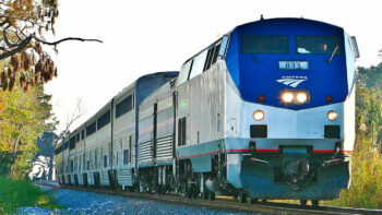
BNSF: Harnessing Drone Tech
In 2014, BNSF was one of the first companies authorized by the FAA to fly commercial drones, such as fixed-wing models and quadcopters. BNSF began by using drones to aid in the manual inspection of the railroad’s more than 13,000 bridges. As needed, drones piloted by the inspection team capture high-definition video of areas not easily seen—assisting in the detection of structural steel failures and indications of stress, for instance. According to John Martin, Director of BNSF | Tech, inspectors can review the footage during flight or load it onto a computer to view on a large monitor.
In 2015, the railroad conducted the first commercial “beyond visual line of sight” (BVLOS) flight without visual observers (VO’s) in the United States covering more than 135 miles of its Clovis Subdivision. In this first flight, BNSF tested the viability of fixed-wing drones to perform inspections using computer vision. This successful demonstration accelerated BNSF’s automated inspection efforts.
Since then, BNSF has expanded the types of drones it employs and in 2021 began routine remote flights; the FAA granted the railroad one of the first national Class G airspace waivers to do so across its 32,500 route-mile network, which spans 28 states and three Canadian provinces. During such BVLOS flights, the drone is flown out of the view of the pilot, who monitors its status from a remote location. Martin likens remote operation to a self-driving car. While the flight mission is “keyed up” by the pilot, the drone operates autonomously on a route designed by the railroad and learned by the drone through AI and machine learning; the pilot can intercede if there is an abnormality.
The FAA waiver allows the railroad to inspect intermodal facility inventory, which helps improve not only yard dwell time but also customer service. “We use drone technology to make sure we always have an accurate inventory of where our customers’ freight is in a facility,” Martin tells Railway Age. This ensures that freight either gets onto the proper train as scheduled, or onto the truck for the last mile delivery. “With millions of containers coming through our terminals every year, being able to precisely locate each shipment is key to efficiency,” he says. “Drones, combined with other automated technologies, provide near real-time location updates of our customer’s containers.”
Adds Ibanez: “When we tell a customer their freight will be there on Monday at 11 a.m., drones are helping us meet those expectations.”
Dedicated drone pilots handle remote operations at BNSF’s Flight Center in Fort Worth, Tex. BNSF performs about 1,200 flight hours per month across two intermodal facilities.
At BNSF, drone technology also plays an important role in incident response and assessing weather emergencies and natural disasters. “Drones help us understand how we can restore service for our customers as quickly as possible,” Martin says. More than 250 employees across its network are licensed pilots who aid in supporting this fast-response capability. Drones also play an important role in freight security, “putting more eyes in the sky” to spot bad actors, for instance.
Additionally, civil engineering teams are deploying drones mounted with LiDAR to plan construction and improvement projects.
What’s next? The Class I railroad is working to expand drone use across not only its intermodal terminals, but also its switch yards. And while it has invested in automated machine vision systems and locomotives equipped with laser profilometer systems to measure track health, BNSF is evaluating how drones can help inspect other critical assets.
Martin tells Railway Age that the railroad is researching fixed-wing drones that can cover 200 miles of track. “The ability to cover longer distances will unlock new capabilities,” he points out. “It’s something we’re actively working on in the industry. We’re also investigating drone swarm technology, where the drones work and communicate with each other autonomously to accomplish a task.”
Last year, the FAA granted BNSF another waiver, which allows a pilot to remotely operate up to six drones simultaneously, helping “efficiently scale the technology.”
In July, the U.S. Department of Transportation released a proposed rule to “normalize” BVLOS flights, including detailed requirements for safe operations (see Performance-Based Regulations, below). BNSF is hopeful that the new rule “takes flight.”
“We’re committed to being on the forefront of how we can leverage [drone] technology to better serve our customers,” Martin sums up.

CSX: Empowering Employees
CSX has been implementing drone technology since 2015. More than 320 FAA Part 107-certified pilots operate 250-plus drones across the company’s bridge, engineering, police, mapping/surveying, and transportation departments. Drones are outfitted with sensors to accomplish different tasks. The police, for instance, have drones with thermal technology to perform surveillance at night for enhanced security operations.
Drones supplement manual bridge inspections to take railroaders out of harm’s way. “That’s been a great success story for us,” CSX Technical Director of GIS Services Patrick Barnett tells Railway Age. “Equipped with collision avoidance, drones allow bridge inspectors to get right up close to the structure and its components to keep those employees safe verses having to get underneath a bridge.”
Drones also help with disaster recovery. “We used them [last fall] following Hurricane Helene and the damage it caused to the Blue Ridge Subdivision,” he says. “Being able to go in there and assess very quickly with drone technology enabled us to make decisions quickly.” Blue Ridge, a 60-mile stretch of railroad in North Carolina and Tennessee that handles some 14 million gross tons of freight annually, suffered extensive damage due to flooding. It has taken roughly 10 months to get the roadbed ready for track panel installation.
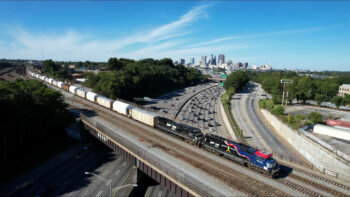
CSX also employs autonomous drone technology at 13 sites spanning 10 yards across its some 20,000 route-mile network in 26 states, the District of Columbia, and the Canadian provinces of Ontario and Quebec. As a supplement to manual inspections, drones outfitted with sensor cameras are helping to measure track gauge, identify broken rail and detect switch-point gaps of greater than 1/8th of an inch, for instance. “The way I like to tell people is we’re flying at 150 feet, and we’re detecting if the [switch-point gap] is greater than the width of a credit card,” Barnett says. “We’re working toward identifying defects that can potentially cause a derailment in a yard.”
In February, the railroad received BVLOS approval from the FAA for autonomous or remote drone operation at those yards. Rollouts to identify track defects will begin at the end of this year. The railroad is approved to fly drones at 150 feet above ground level and operate at two-plus miles in each direction from where the drone site is located through 2027, according to Barnett. Hypothetically, he says, an employee working as a “drone pilot” at the Command-and-Control Center in Jacksonville, Fla., could be overseeing drone operations in New York. An employee in a yard office could launch the operation via the CSX computer system, confirming that a track is clear, for example. This action would trigger the drone to perform an automated and programmed inspection and stream data to the Command-and-Control Center in real time.
With the new FAA waiver, “we went from needing three individuals on the ground to operate a drone to not needing someone there, so that has been a monumental milestone for our company, and it’s one that leads the industry and something we’re very proud of,” Barnett says.
In the future, CSX expects to implement remote drone operations at additional yards and consider implementing drones for line-of-road track inspections. “This will take additional dialogue with our federal regulators because we are talking about a vision of inspecting 50 miles at a time,” he says, noting that CSX would pair drones with other types of technologies. Combined, that would not only reduce track time and improve operations but also increase railroader safety. “Safety is our number one priority,” Barnett stresses.
Performance-Based Regs
Last month, the FAA and Transportation Security Administration proposed “performance-based regulations to enable the design and operation of UAS at low BVLOS altitudes and for third-party services, including UAS Traffic Management, that support these operations.” Comments are due on or before Oct. 6, 2025.
The proposal is necessary to support the integration of UAS into the national airspace system, according to the FAA and TSA in their Notice of Proposed Rulemaking. It is also intended to provide a “predictable and clear pathway for safe, routine, and scalable UAS operations that include package delivery, agriculture, aerial surveying, civic interest [to include wildfire recovery, wildlife conservation, and public safety], operations training, demonstration, recreation, and flight testing.” According to the FAA and TSA, operations would occur at or below 400 feet above ground level, from “pre-designated and access-controlled locations.” The TSA also proposes making “complementary changes to its regulations to ensure it can continue to impose security measures on these operations under its current regulatory structure for civil aviation.”
“To date, the FAA has allowed some such [BVLOS] operations through individualized exemptions and waivers to existing regulations,” according to the NPRM. “This NPRM leverages lessons learned from individual exemptions and waivers to create the repeatable, scalable regulatory framework … that would allow for widescale adoption of UAS technologies.”
Under the proposed rule, all operators would need FAA approval for the area where they intend to fly. They would identify boundaries and the approximate number of daily operations, as well as takeoff, landing, and loading areas, the FAA explained in a fact sheet. They also “would ensure adequate communications coverage and procedures in cases where the communications with the drone are lost.” The FAA noted operators “would have to be familiar with airspace and flight restrictions along their intended route of flight including reviewing Notices to Airmen,” and “be required to identify and mitigate any hazards.”
Operators would also use Automated Data Service Providers “to support scalable BVLOS operations,” the FAA said. “ADSPs could provide services to keep BVLOS drones safely separated from each other and manned aircraft.” The FAA would approve and regulate these entities and require services to “conform to industry consensus standards following vetting and testing.”
Additionally, drones would have technologies that “enable them to automatically detect and avoid other cooperating aircraft,” the FAA said. They would also “yield to all manned aircraft broadcasting their position using ADS-B” and “could not interfere with operations and traffic patterns at airports, heliports, seaplane bases, space launch and reentry sites or facilities where electric Vertical Takeoff and Landing aircraft take off or land.”
“It is encouraging to see this long-overdue BVLOS rule released,” Association of American Railroads President and CEO Ian Jefferies says. “America’s freight railroads commend Secretary [Sean P.] Duffy and the USDOT for advancing a forward-looking policy that could help unlock the full potential of unmanned aircraft systems across our national transportation network. Routine BVLOS operations hold tremendous potential for railroads—enhancing safety, speeding up inspections, and improving emergency response in ways that were previously limited. AAR members have long advocated for a rule that offers clarity, scalability, and meaningful safety benefits, and while we are still reviewing the rule in full, we are optimistic that [the] action represents a significant milestone toward that goal.”
SUPPLEMENTING FRA-MANDATED MANUAL/VISUAL INSPECTIONS
Will federal regulations be updated to incorporate advanced tech like drones as part of the track inspection process? “While we can’t speculate about specific future regulatory developments concerning track inspections, FRA will continue to explore and embrace industry’s use of new and innovative technologies including UAVs in railroad operations,” FRA tells Railway Age, noting that railroads use drones for a variety of applications, including for bridge inspections as long at such use is part of the approved bridge management plan. It added that while “FRA is aware that railroads are interested in using drones as part of their track inspection processes, from a technical perspective at this point, drones are of limited utility for track inspection because they cannot measure the track under load.” Following is FRA-sponsored research:
Railroad Bridge Inspection Using Drone-Based Digital Image Correlation. https://railroads.dot.gov/elibrary/railroad-bridge-inspection-using-drone-based-digital-image-correlation, 2023.
Utilization of Unmanned Aerial Vehicles in Accident Reconstruction. https://railroads.dot.gov/elibrary/utilization-unmanned-aerial-vehicles-accident-reconstruction, 2022.
Automated Track Centerline Following for Drone Flight Automation. https://railroads.dot.gov/elibrary/automated-track-centerline-following-drone-flight-automation, 2022.
Line-of-Sight Analysis Using Drones and Photogrammetry. https://railroads.dot.gov/elibrary/line-sight-analysis-using-drones-and-photogrammetry, 2021.
AXIS: An Automated, Drone-Based, Grade Crossing Inspection System. https://railroads.dot.gov/elibrary/axis-automated-drone-based-grade-crossing-inspection-system, 2020.
An Automated, Drone-Based Inspection System. https://railroads.dot.gov/elibrary/automated-drone-based-inspection-system, 2020.